What you can see on the Isla Verde cams
Four cameras watch the same stretch of sand from different heights. From high up you get the whole scene at once: pools and palms, the beach, the white line of the surf and the blue of the open sea. Closer to the ground the view is about the sand itself, the people walking it and the state of the water. Two of the cameras are scientific and take a still photo every hour of daylight, one aimed out to sea and one along the curve of the shore.
Isla Verde from the top of a resort tower
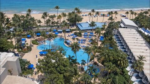
This camera looks down from high on the tower of a beachfront hotel that opened in 1956 as the Americana and reopened as the Royal Sonesta in 2021. In the foreground lie the resort's free-form pool, its cabanas and a grove of palms; past the fence comes the beach, with rows of blue umbrellas and loungers, then the white line of the breaking waves and the open Atlantic to the horizon.
Because it takes in so much sand at once, it is the best of the four Isla Verde cameras for judging how busy the beach is and whether the sea is flat or white with waves. Ozolio, which films hotels and resorts for their websites, produces the stream.
The beach at sand level, from Casa Cuba
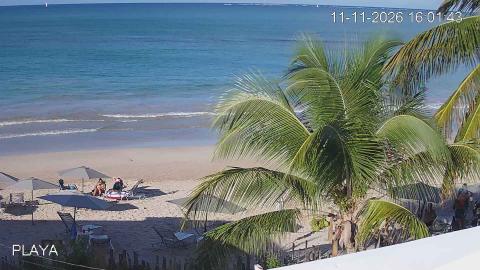
Casa Cuba, the main Cuban social club in Puerto Rico, keeps this camera on its terrace, low over Isla Verde beach. A coconut palm fills the right of the frame; the rest is open sand, the shoreline and the sea, with a low island far out on the horizon on clear days.
From this height you see the beach as someone standing on it would: the lines left by the morning beach cleaning, the first swimmers, the size of the waves where they break on the sand. The date and time printed in the corner tell you the picture is live.
A research camera aimed at the surf
On a pole about 22 meters high beside Pine Grove, the U.S. Geological Survey has kept cameras on Isla Verde since August 2022. This one points northeast, over the beach and the surf zone to the open sea. It photographs the coast at regular intervals through the day, and scientists use the images to measure where the shoreline lies, how far the waves run up the sand and how the sandbars move, with the aim of forecasting coastal flooding in real time.
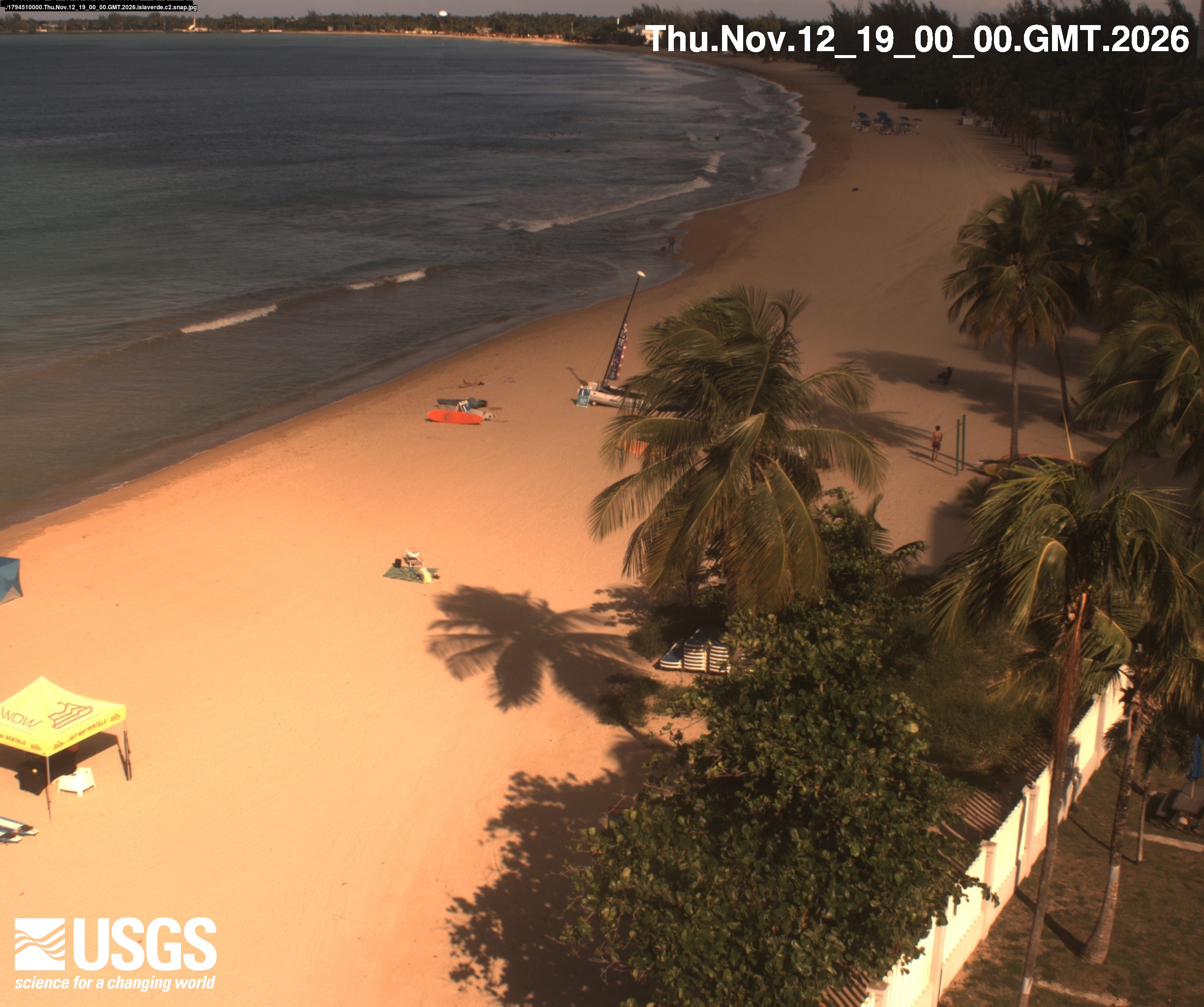
For anyone else it is a wide, sharp view of the waves and the water level. The time printed in the corner is in GMT, four hours ahead of Puerto Rico.
Along the curve of Isla Verde beach
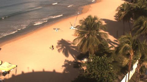
The second camera of the same research station turns east-northeast and follows the beach as it curves away past the palms and a white fence. It is the frame for reading the shoreline: how wide the sand is today, where the waves stop and how the beach looks after a storm.
The station has a history here. An earlier USGS project on this beach, funded after hurricanes Irma and María, studied how waves cross coral reefs and flood tropical coasts, because the reef offshore is what protects this shore in a big storm. A new still arrives every hour of daylight; at night the last photo of the evening stays up.
A reef with its own marine reserve
The district takes its name from a small green cay about 400 meters off Punta del Medio. The reef around it became the Isla Verde Reef Marine Reserve in 2012, the first marine reserve of the San Juan metropolitan area. The law that created it points to living coral, including threatened elkhorn and staghorn, to sea fans, to leatherback and hawksbill turtles that nest on the beach, and to manatees that come to graze the seagrass. Surfing, paddleboarding, kayaking and snorkeling are all allowed inside it.
When to watch Isla Verde
Mornings tend to be the quietest hour on the beach, with soft light and few people on the sand. The trade winds blow from the east, so the afternoon sea is often choppier. From roughly November to March, swells from the North Atlantic reach this coast and the surf picks up; from June to November it is hurricane season, when the cams show what the storms do to the shoreline.
Nearby
At the western end, Pine Grove is known for small, steady waves that suit people learning to surf. The Balneario de Carolina, a public beach with facilities, closes the district to the east. Beyond it a seaside path of about four miles runs through the mangroves of Piñones, famous for its roadside kiosks of fried snacks. Condado and Old San Juan are a short drive west.
Getting there
The airport is minutes away, which makes Isla Verde a common first or last night in Puerto Rico. The calmest swimming is behind the reef; where waves break straight onto the sand, watch the flags and the lifeguards before going in.