USGS CoastCam at Isla Verde
The US federal science agency for natural hazards and landscapes; its CoastCams photograph beaches to study shoreline change, wave run-up and flooding.
The U.S. Geological Survey is the federal science agency of the United States for natural hazards, water and landscapes. Its CoastCams are fixed cameras that photograph beaches at regular intervals, usually every 30 to 60 minutes, so that scientists can turn the pictures into measurements of the coast.
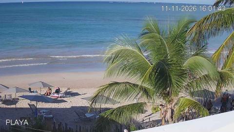
At Isla Verde the USGS installed its camera system in August 2022 on a pole about 22 meters high next to Pine Grove beach. The station has two cameras, one aimed northeast out to sea and one east-northeast along the beach, and it works during daylight. From the images researchers estimate the position of the shoreline, how far waves run up the sand, how sandbars migrate and how currents move along the shore, with the aim of forecasting coastal water levels in real time. The work is led by the St. Petersburg Coastal and Marine Science Center.
It is not the first USGS project on this beach. After hurricanes Irma and María, an earlier deployment from 2018 to 2019 studied how waves cross coral reefs and cause flooding on tropical coasts, together with NOAA, the University of Puerto Rico at Mayagüez and the local group Arrecifes Pro Ciudad. The images are public domain, as works of the U.S. federal government.
Places with cams from U.S. Geological Survey
U.S. Geological Survey in numbers
- Cams
- 2 cams · 1 place · Puerto Rico
- How you watch them
- 2 as still images (refreshed every 60 minutes)
- Right now
- 0 of 2 broadcasting
- Terms
- Public domain (work of the US federal government)
Website: cmgds.marine.usgs.gov/data/islaverde.