What you can see on the Guánica cam
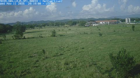
The image comes from the top of a research tower that rises above the canopy, looking north across a hillside of low, dense trees. Among the species that fill the frame is the gumbo-limbo, easy to spot by its peeling reddish bark. The camera is there to record the seasons, and it does it well: in the dry months, roughly December to April, nearly half the trees drop their leaves and the slope turns grey and brown; with the rains of late summer and autumn it flushes green again.
The dry-forest canopy, season by season
From the top of NEON's 23-meter research tower, this camera looks north over the canopy of the Guánica Dry Forest toward a ridge on the horizon. It is a PhenoCam: one of a network of cameras that photograph vegetation at fixed intervals so that scientists can follow its phenology, the timing of leaves coming out, changing color and falling.
NEON's cameras take a color and an infrared image every 15 minutes, and the archive at this site goes back to December 2016. The trees in the frame include the gumbo-limbo, whose leaves drop in the dry season, which is when this hillside turns from green to brown.
A forest made for drought
Guánica is the driest corner of Puerto Rico, with under 800 millimeters of rain a year in most records. Even so it holds more than 700 plant species, 48 of them endangered and 16 found nowhere else, and a lignum vitae tree known as the Guayacán Centenario that may be a thousand years old. About half of Puerto Rico's bird species live here, including nine of its sixteen endemic birds. The Puerto Rican nightjar, believed extinct, was rediscovered in this forest in 1961, and the last wild population of the Puerto Rican crested toad survives here too.
Why scientists watch this canopy
The tower belongs to NEON, the National Ecological Observatory Network funded by the U.S. National Science Foundation. Guánica is its main land site in Puerto Rico, measuring air, soil and plants since 2017, and the camera on top takes a picture every 15 minutes so that researchers can date leaf fall and regrowth year after year. The forest has been battered by hurricanes, from Hugo in 1989 to Irma and María in 2017, and the record shows how it recovers.
When to watch Guánica
Look in daylight, and come back in different months: the difference between a February and an October canopy is the whole point of this camera.
Nearby
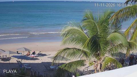
Balneario Caña Gorda, a public beach, is a short drive away, facing the mangrove cays of Caña Gorda, one of which locals call Gilligan's Island. Fortín Caprón, a stone lookout tower built in 1936, rises over Guánica Bay.
Getting there
The forest has hiking trails through cactus scrub down to the sea. There is little shade along the way, so carry plenty of water and avoid the hottest hours.