What you can see on the Lindbergh Bay cam
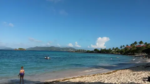
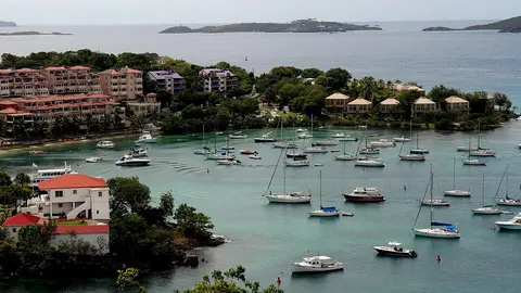
The camera is on a floating bar moored in the bay. It looks over the bar's yellow floats and the calm water to the boats at anchor and the hillsides of St Thomas, dotted with houses, behind the shore.
Floats and boats in Lindbergh Bay
From a floating taco bar moored in Lindbergh Bay, this camera looks past the bar's deck and its row of yellow floats over the calm water of the bay to the anchored boats and the hillsides of St Thomas, dotted with houses.
It shows how calm the bay is and how many boats are around, and the clouds building over the hills of St Thomas.
The bay of the aviator
The bay takes its name from Charles Lindbergh, who landed his plane near here in 1928, on a tour of the Caribbean after his transatlantic flight. The airport was later built along the shore, so planes on their final approach pass low over the water just west of the bay. Its sheltered water makes it a favourite anchorage close to town.
When to watch Lindbergh Bay
St Thomas keeps Atlantic Standard Time all year, four hours behind UTC. The bay faces south and is sheltered from the trade wind, so its water is usually calm. The hurricane season runs from June to November.
Nearby
Charlotte Amalie, the capital of the US Virgin Islands, with its harbour, its cruise piers and its old Danish warehouses, is a few minutes east. Brewers Bay, on the other side of the airport, is a quieter beach next to the university campus.
Getting there
The bay is just off the main road from the airport to Charlotte Amalie, so it is often the first beach visitors see. Cars drive on the left, as in the rest of the Virgin Islands.