Guadeloupe webcam
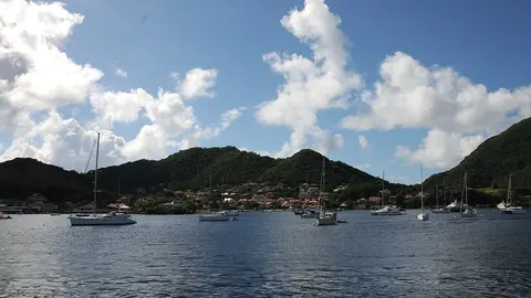
Terre-de-Haut, in the islands of Les Saintes south of Guadeloupe.
Guadeloupe, place by place 1
No place matches this search.
Photos: Terre-de-Haut: Josep M. Gracia, CC BY-SA 4.0.
A butterfly and its islands
Guadeloupe is a French overseas department shaped like a butterfly: two main islands, the mountainous Basse-Terre and the flatter Grande-Terre, separated by a narrow channel, the Rivière Salée, with smaller islands around them: Marie-Galante, La Désirade and the little archipelago of Les Saintes. It has about 380,000 people, a volcano, La Soufrière, and long beaches on its southern and western coasts.
Les Saintes
Les Saintes lie about 10 km (6 miles) south of Basse-Terre. Terre-de-Haut, the most visited of the islands, has a single village of colourful houses around a bay often listed among the most beautiful in the world, overlooked by Fort Napoléon on its hill. There are few cars; visitors arrive by ferry and get around on foot or by scooter.
When to watch Guadeloupe
Guadeloupe keeps Atlantic Standard Time all year, four hours behind UTC. The driest months run from about January to April; the hurricane season lasts from June to November.