What you can see on the Cinnamon Bay cams
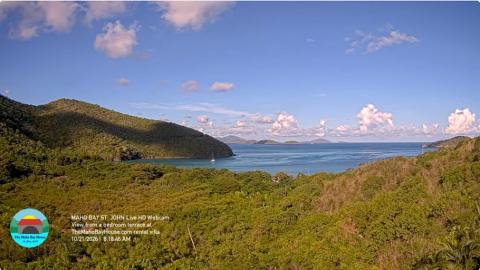
One view looks north-east over the treetops to the beach, the turquoise shallows around Cinnamon Cay and, beyond the next point, Francis Bay, Whistling Cay and the hills of Jost Van Dyke and Tortola in the British Virgin Islands. The other turns north-west, over the villas of Peter Bay and along the coast to Lovango Cay and the islands between St John and St Thomas. Together they show the color of the water, the clouds coming in on the trade wind and how many boats are moored in the bays.
Cinnamon Bay from La Jolla Caribe
From a villa high in Estate Catherineberg, this camera looks north-east over the forest of the national park to the curve of Cinnamon Bay, its pale sand and the turquoise shallows around little Cinnamon Cay. Beyond the next point lie Francis Bay and Whistling Cay, and on the horizon the hills of Jost Van Dyke and Tortola, in the British Virgin Islands.
The villa streams it with its name, the date and the time across the bottom of the picture, and the framing shifts a little from one day to the next.
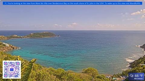
Peter Bay and Lovango Cay from La Jolla Caribe
From the same villa, this camera turns north-west: down the wooded slope to the roofs of the villas around Peter Bay, then along the north shore of St John and out over deep-blue water to Lovango Cay and the small islands strung between St John and St Thomas.
It takes in more sky and open sea than the other view, so it is the one for watching the clouds and the passing showers come in on the trade wind.
Taíno ceremonies and Danish sugar
People came to this beach long before the Europeans: excavations at Cinnamon Bay have found the remains of a Taíno ceremonial site, and volunteers have taken part in the digs. After Denmark claimed St John in 1718, the slopes behind the bay were cleared for sugar cane worked by enslaved Africans. The stone ruins of the Cinnamon Bay plantation stand across the road from the beach, on a short loop trail through the forest.
When to watch Cinnamon Bay
St John keeps Atlantic Standard Time all year, four hours behind UTC. The trade wind blows from the east most of the year and the north shore is usually calm; in winter, swells from distant Atlantic storms can roll onto the beach for a few days. The dry, sunny season runs from December to April, and the hurricane season from June to November.
Around Cinnamon Bay
Maho Bay, about a mile to the east, is the beach for swimming with green sea turtles, and Francis Bay lies just beyond it. To the west, Trunk Bay has its underwater snorkel trail. Cruz Bay, the ferry town, is about 15 minutes away by road.
Visiting Cinnamon Bay
The beach is on the North Shore Road, with parking and safari taxis from Cruz Bay. Cinnamon Bay has the only campground inside the national park, with cottages, tents and a beach shop. Snorkelers swim out to Cinnamon Cay over the shallow reef; the beach has no lifeguards, and in the park nothing may be taken from the reef or the ruins.