What you can see on the Terre-de-Haut cam
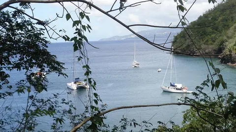
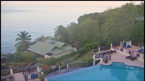
The camera looks from a hotel on the hillside above Anse à Cointe, over its red roofs and palms, to the jetty, the small beach and the bay with its boats at anchor, and to the green islets at its mouth. A time-lapse replays the last 24 hours.
Anse à Cointe, Terre-de-Haut
From a hotel on the hillside above Anse à Cointe, on the west coast of Terre-de-Haut, this wide-angle camera looks over red roofs, palms and gardens to a little beach and its jetty, the bay with boats at anchor and, at its mouth, the green islets and hills of Les Saintes. Windy replays the last 24 hours.
It shows the sheltered side of the island, where the water is calm, and the clouds passing over Les Saintes.
Fishermen and sailors
The islands of Les Saintes are too dry for sugar cane, so they were never plantation islands: they were settled by fishermen from Brittany and Normandy, whose descendants still fish from the village in small boats called saintoises. Fort Napoléon, built in the 19th century on the hill above the bay, now houses a museum and a garden of cactuses; the Battle of the Saintes was fought offshore in 1782.
When to watch Terre-de-Haut
Guadeloupe keeps Atlantic Standard Time all year, four hours behind UTC. The bay is busiest in the morning, when the ferries arrive from Guadeloupe, and quietest after they leave in the afternoon. The hurricane season runs from June to November.
Nearby
Pompierre, a sheltered beach on the east coast, and the cove of Pain de Sucre, below a basalt peak, are a short walk from the village. Terre-de-Bas, the other inhabited island of Les Saintes, is a few minutes away by boat.
Getting there
Ferries leave from Trois-Rivières, on Basse-Terre, and from Pointe-à-Pitre; the crossing from Trois-Rivières takes about 20 minutes. There are few cars on the island: visitors walk or rent scooters and electric carts.